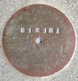
Name:        BIKINI
Identifier:
Lat/Lon:     N 32° 47.141 W 117° 13.920
Elevation:   54 FEET
Year:
Address:     3700 CORONA ORIENTE RD, SAN DIEGO CA 92109
Vicinity:    click here
Survey Date: 2/12/2014
Description: click here
Page 2 of 7 previous page | next page
|
| Name: BIKINI Identifier: Lat/Lon: N 32° 47.141 W 117° 13.920 Elevation: 54 FEET Year: Address: 3700 CORONA ORIENTE RD, SAN DIEGO CA 92109 Vicinity: click here Survey Date: 2/12/2014 Description: click here |
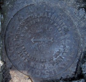
| Name: STOCKTON NO 3 Identifier: DC1490 Lat/Lon: N 32° 45.431 W 117° 11.652 Elevation: 193 FEET Year: 1933 Address: PRESIDIO DR AT COSOY WAY, SAN DIEGO CA 92103 Vicinity: click here Survey Date: 2/13/2014 Description: click here |
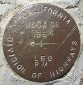
| Name: LEG Identifier: DC1578 Lat/Lon: N 32° 44.706 W 117° 0.495 Elevation: 600 FEET Year: 1964 Address: 3570 HARTZEL DR, SPRING VALLEY CA 91977 Vicinity: click here Survey Date: 2/17/2014 Description: click here |
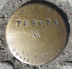
| Name: 749+73 Identifier: Lat/Lon: N 32° 46.792 W 116° 59.366 Elevation: 677 FEET Year: Address: MURRAY DR AT WATER ST, EL CAJON CA 92020 Vicinity: click here Survey Date: 2/21/2014 Description: click here |
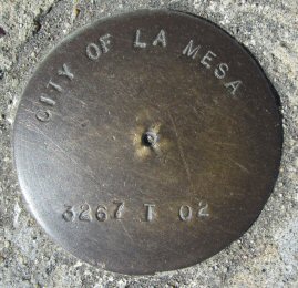
| Name: 3267-T-02 Identifier: Lat/Lon: N 32° 46.792 W 116° 59.364 Elevation: 677 FEET Year: Address: MURRAY DR AT WATER ST, EL CAJON CA 92020 Vicinity: click here Survey Date: 2/21/2014 Description: click here |
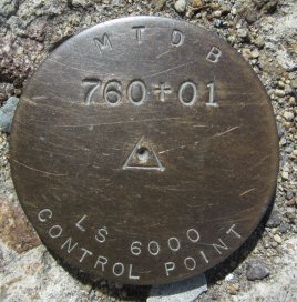
| Name: 760+01 Identifier: Lat/Lon: N 32° 46.775 W 116° 59.174 Elevation: 653 FEET Year: Address: EL CAJON BLVD AT MURRAY DR, EL CAJON CA 92020 Vicinity: click here Survey Date: 2/21/2014 Description: click here |
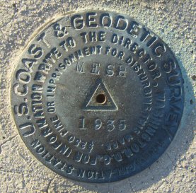
| Name: MESH Identifier: DC0200 Lat/Lon: N 32° 42.227 W 116° 21.626 Elevation: 4102 FEET Year: 1935 Address: OLD HWY 80 AT CRESTWOOD RD, CAMPO CA 91962 Vicinity: click here Survey Date: 2/21/2014 Description: click here |
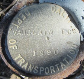
| Name: VAUCLAIN Identifier: DC1517 Lat/Lon: N 32° 45.523 W 117° 9.890 Elevation: 290 FEET Year: 1990 Address: 4311 3RD AVE, SAN DIEGO CA 92103 Vicinity: click here Survey Date: 2/25/2014 Description: click here |
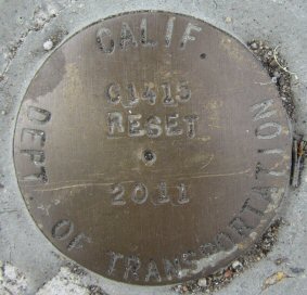
| Name: C1415 RESET Identifier: Lat/Lon: N 32° 44.838 W 117° 11.606 Elevation: 40 FEET Year: 2011 Address: 3801 OLD TOWN AVE, SAN DIEGO CA 92103 Vicinity: click here Survey Date: 2/26/2014 Description: click here |
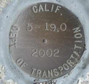
| Name: 5-19.0 Identifier: Lat/Lon: N 32° 44.857 W 117° 11.600 Elevation: 47 FEET Year: 2002 Address: 3815 OLD TOWN AVE, SAN DIEGO CA 92103 Vicinity: click here Survey Date: 2/26/2014 Description: click here |
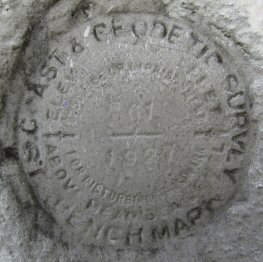
| Name: H61 Identifier: DC0850 Lat/Lon: N 32° 44.911 W 117° 8.699 Elevation: 353 FEET Year: 1927 Address: 1901 UNIVERSITY AVE, SAN DIEGO CA 92104 Vicinity: click here Survey Date: 2/27/2014 Description: click here |
| Name: H18 Identifier: Lat/Lon: N 32° 43.875 W 117° 9.469 Elevation: 264 FEET Year: 1938 Address: 701 EL PRADO, SAN DIEGO CA 92103 Vicinity: click here Survey Date: 3/3/2014 Description: click here |
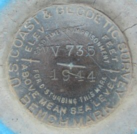
| Name: VV735 Identifier: DC0853 Lat/Lon: N 32° 44.567 W 117° 11.214 Elevation: 30 FEET Year: 1944 Address: 3501 NOELL ST, SAN DIEGO CA 92110 Vicinity: click here Survey Date: 3/3/2014 Description: click here |
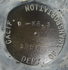
| Name: 8-K6.3 Identifier: Lat/Lon: N 32° 46.196 W 117° 8.391 Elevation: 68 FEET Year: 1996 Address: 2000 QUALCOMM WAY, SAN DIEGO CA 92108 Vicinity: click here Survey Date: 3/5/2014 Description: click here |
| Name: COWLES 1930 Identifier: Lat/Lon: N 32° 48.770 W 117° 1.914 Elevation: 1602 FEET Year: 1930 Address: 7035 GOLFCREST DR, SAN DIEGO CA 92119 Vicinity: click here Survey Date: 3/6/2014 Description: click here |
| Name: COWLES Identifier: Lat/Lon: N 32° 48.772 W 117° 1.915 Elevation: 1599 FEET Year: 1977 Address: 7035 GOLFCREST DR, SAN DIEGO CA 92119 Vicinity: click here Survey Date: 3/6/2014 Description: click here |
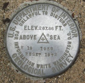
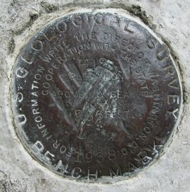
| Name: H19 Identifier: Lat/Lon: N 32° 43.900 W 117° 8.846 Elevation: 262 FEET Year: 1938 Address: 1788 EL PRADO, BALBOA PARK, SAN DIEGO CA 92101 Vicinity: click here Survey Date: 3/7/2014 Description: click here |
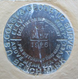
| Name: M57 Identifier: DC0887 Lat/Lon: N 32° 42.983 W 117° 10.189 Elevation: 49 FEET Year: 1926 Address: 1050 KETTNER BLVD, SAN DIEGO CA 92101 Vicinity: click here Survey Date: 3/9/2014 Description: click here |
| Name: COURTHOUSE Identifier: Lat/Lon: N 32° 42.943 W 117° 9.906 Elevation: 55 FEET Year: 1942 Address: 220 W BROADWAY, SAN DIEGO CA 92101 Vicinity: click here Survey Date: 3/9/2014 Description: click here |
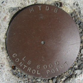
| Name: LS 6000 Identifier: Lat/Lon: N 32° 42.196 W 117° 9.285 Elevation: 55 FEET Year: Address: HARBOR DR & PARK BLVD, SAN DIEGO CA 92101 Vicinity: click here Survey Date: 3/9/2014 Description: click here |
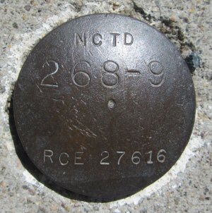
| Name: 268-9 Identifier: Lat/Lon: N 32° 42.194 W 117° 9.282 Elevation: 55 FEET Year: Address: HARBOR DR & PARK BLVD, SAN DIEGO CA 92101 Vicinity: click here Survey Date: 3/9/2014 Description: click here |
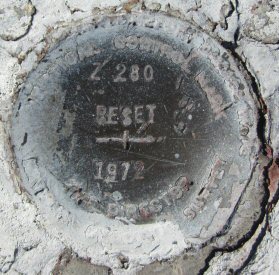
| Name: Z280 Identifier: DC0710 Lat/Lon: N 32° 44.952 W 117° 5.027 Elevation: 317 FEET Year: 1972 Address: 5150 UNIVERSITY AVE, SAN DIEGO CA 92105 Vicinity: click here Survey Date: 3/11/2014 Description: click here |
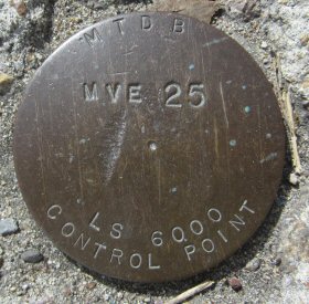
| Name: MVE25 Identifier: Lat/Lon: N 32° 46.343 W 117° 1.630 Elevation: 501 FEET Year: Address: 5100 BALTIMORE DR, LA MESA CA 91941 Vicinity: click here Survey Date: 3/11/2014 Description: click here |
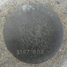
| Name: 3167R02 Identifier: Lat/Lon: N 32° 46.784 W 117° 0.081 Elevation: 675 FEET Year: Address: 9095 MURRAY DR, LA MESA CA 91942 Vicinity: click here Survey Date: 3/11/2014 Description: click here |
| Name: O61 Identifier: DC0522 Lat/Lon: N 32° 47.253 W 116° 58.489 Elevation: 487 FEET Year: Address: 711 EL CAJON BLVD, EL CAJON CA 92020 Vicinity: click here Survey Date: 3/11/2014 Description: click here |